After advertising for several weeks, I finally settled on the fact that this was going to be a solo trip. No one was able to get enough time off or really wanted to suck air at high elevation with me. Soloing brings it's own excitement as well as increased caution. The room for error that far from help just gets a lot smaller. But my plan was simple, get above 11,000 feet and more or less stay there working through the ranges for 4-5 days.
I drove out to Silverton Colorado after work and spent the night in my truck. I caught the train heading south early afternoon the next day. I anticipated only needing a one way ticket (plans would change later), but carried some extra cash anyway if I had to flag the train down on the way back. While expensive, the Durango-Silverton Narrow-Gage Railroad is the fastest way to get into the wilderness area. Plus the nostalgia is hard to pass up.
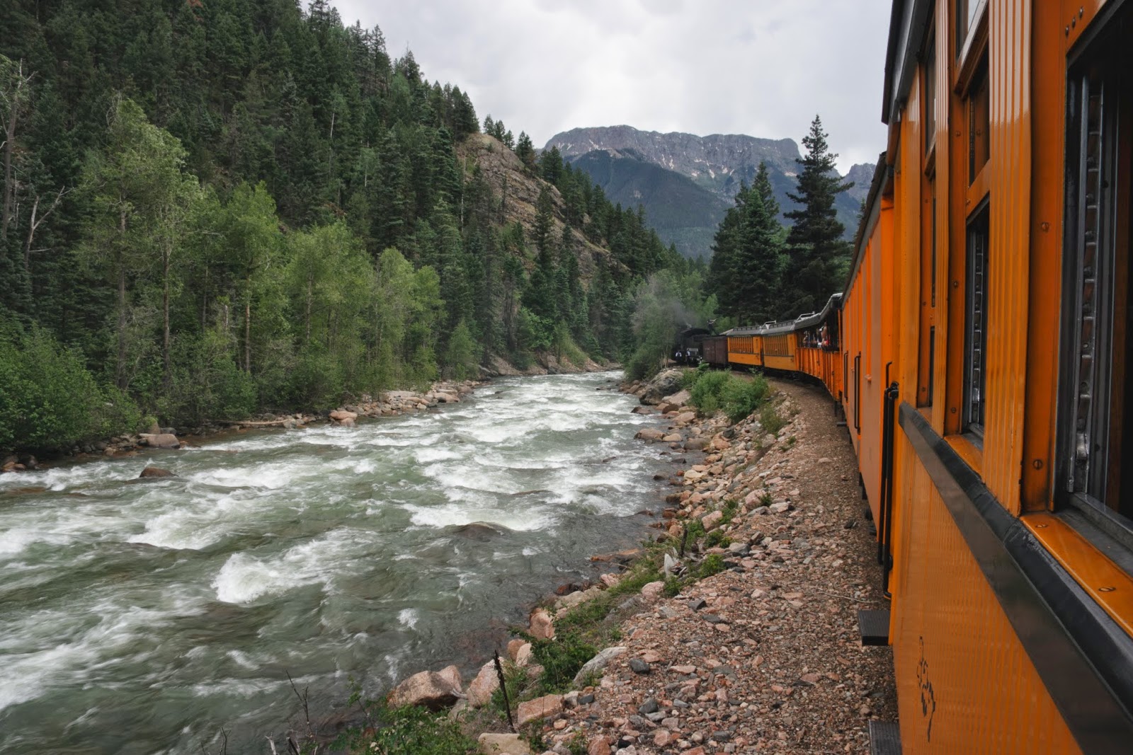
I was dropped off at Needleton around 3:00pm. Needleton is marked as a town on maps, but it's really a bridge over the Animas River and a couple of private cabins (where can I buy those?) on the River. I wanted to get some miles under my belt today and had a pretty challenging trail to start off with so I kept the pace pretty quick early. The trail was overgrown and faint. In fact it wasn't really a trail, more of a use path and series of game trails. I was heading up Ruby Basin, tentatively planning to stay at Ruby Lake the first night. I had marked some GPS points to guide me on this first section since I knew if I got off path I'd have a long afternoon in thick brush. So with my GPS out I wandered up hill, crossing a few creeks and ticking off the GPS waypoints as I went. I lost the path a couple times, nearly ran into an elk, but never had any major issues. I arrived at Ruby lake around 5:30 just in time to see the sun drop behind the mountains.
Pigeon Peak

Looking up Ruby Basin toward North Eolus

Ruby lake was absolutely full of cut-throat trout. Definitely coming back with a fly rod. It was a nice evening. The first and only day I wouldn't get rained on.
The next morning I planned to head all the way up Ruby Basin, drop over into No-name Basin and then around Jagged Peak. It was a gamble. I knew my weather was going to deteriorate today and after leaving No-name I would be on an exposed pass for several miles before dropping back to a safer elevation.
The path I had followed to Ruby more or less abandoned me after the lake. The difficult route finding was behind me though, it was more about finding the path of least resistance until I got above the willows. Once above any vegetation taller then ankle (around 11,500'), I was in my happy zone. Alpine meadows really get into my soul.
The path I had followed to Ruby more or less abandoned me after the lake. The difficult route finding was behind me though, it was more about finding the path of least resistance until I got above the willows. Once above any vegetation taller then ankle (around 11,500'), I was in my happy zone. Alpine meadows really get into my soul.

Peak Fifteen and Turret Peak


Finally topped out at the Ruby/No-name Pass and scrambled up Peak 12 to around 13,120'.

Looking down No-name Basin and the decision, do I descend this way?

Or this way after traversing farther to the north?

I voted option one, and with majority rule I worked my way down. While it was early in the season, and snow still in a lot of places, the flowers were starting to blanket the meadows.

Monitor Peak in the background


Jagged Peak and Knife Point

Animas Mountain and Monitor Peak


As I started to ascend around the western face of Jagged Peak, my weather luck ran out. Rain, hail and prolific lightening forced me back down. I dropped all the way to a flat spot next to no-name creek and hunkered under a clump of trees for a few hours hoping to get a weather window that never came. I had wanted to get several more miles in that day, but cut my losses and set up camp.
That night I was reminded of my ongoing feud with rodents. I had set my alarm for 5:00 am but woke up around 3:30 to what sounded like something rubbing against the vestibule of my tent. Not being that uncommon of an occurrence, I made some noise scaring whatever it was off then rolled back over. I woke up again about 30 minutes later to what (in my half zombie state) sounded like a woodpecker working the truck of a tree next to my camp. Not thinking anything of it, I continued to lay there. Then as my brain turned on, I thought to myself... "why would a woodpecker be out at 4am?" I crawled out of my tent and caught the big guy red handed!
That night I was reminded of my ongoing feud with rodents. I had set my alarm for 5:00 am but woke up around 3:30 to what sounded like something rubbing against the vestibule of my tent. Not being that uncommon of an occurrence, I made some noise scaring whatever it was off then rolled back over. I woke up again about 30 minutes later to what (in my half zombie state) sounded like a woodpecker working the truck of a tree next to my camp. Not thinking anything of it, I continued to lay there. Then as my brain turned on, I thought to myself... "why would a woodpecker be out at 4am?" I crawled out of my tent and caught the big guy red handed!

This porcupine was systematically chewing all the grip off of my trekking poles like they were corn on the cob looking for salt. He also chewed goofball sized holes in my bandana. I ran him off down the hill and started to pack up camp. He would wait until I wasn't paying attention to him, then sneak right back up and start again! This continued for three or four times! he would go down and act like he was foraging on some vegetation, then sneak up from a different angle and stain what was left of my blue bandana with his now green vegetated saliva. He had found his salty mineral lick and couldn't get enough of it. I finally got everything packed up to end the rodent attack. Its a good thing he is cute.

With my nice early start I headed again for the Jagged Peak pass.
Jagged Peak on the left with my pass on the far left.


Looking back down No-name Basin

A steep climb brought me to the top of No-name/Sunlight pass (13,050').

Looking down Sunlight Basin

I carefully traversed across the lower north face of Jagged Peak to get to the pass to drop me into Leviathan Basin. Jagged Peak is a technical class 5 climb I have been eyeing for a while, so this gave me a chance to scout it out for a future trip. It's supposed to be one of the better technical climbs in the range.

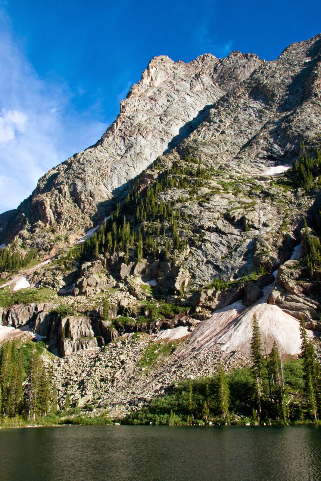
Once I made it over to the Sunlight/Leviathan Pass I was in for a rude surprise. Deep snow was totally blocking my descent. I had opted to not carry my ice axe in an attempt to save weight, but now I was really regretting it. A very very slow and careful descent followed with lots of post-holing up to my waist. I definitely took my time since I knew a twisted knee, ankle or untimely slide would be all too easy. However when I did reach the bottom, I hit the crown jewel of the trip, Leviathan Lake.


I just couldn't get over the blue.


I had to make a decision here. It was still early in the day, but the clouds had once again rolled in and I could hear heavy thunder moving towards me in the distance. When I left Leviathan Lake I would be either highly exposed or on really rocky slopes for the next several miles, in other words, no good place to find shelter or even pitch a tent. Since I was solo, rock hopping wet rocks didn't sound great either. I decided to just call it an early day and camp at Leviathan. The rain, and hail were close behind too. I barely got my tent up 20 minutes later before it hit. I spent most of the afternoon that day hiding in my tent, only emerging to cook dinner.
The next morning around 4:30, I packed up camp and headed by headlight out of Leviathan Basin towards Silex. I got an early start since I knew I had about one night before I needed to be back and a lot of miles to cover, as well as four 12-13,000' passes. Not a whole lot of light for pictures until I reached Balsam Basin and the pass above Lake Silex (12,825').

Lake Silex is really just a tarn surrounded by steep mountains, scree, and talus slopes

Looking back at the way I came, and the amount of rock hopping I did between Silex and Leviathan I was happy I avoided the wet rocks yesterday.
Peak Nine, I came from the pass to the right.


I dropped down and around the north side of the Trinities and then started working my way up the Trinity Basin.
Water stop with Storm King and the Trinities in the background

Once I reached the top of Trinity Basin (12,700') I encountered my constant companion for the trip... thunder clouds, and this time they had really snuck up on me. As soon as I crested over the pass and looked down into next un-named canyon, I knew I needed to hurry. Lots of miles to go, and not a lot of cover until tree line. With the amount of hail and lightening these storms were producing I did not want to get caught. My next major landmark was when I hit Elk Creek at the bottom of the canyon. Progress was going smooth and quickly until I hit a water fall. Didn't really see this coming on the aerials and topos I'd studied. It was about this point the rain started too. Great, slick rock... I found a cliff band and slowly and carefully down climbed until I could cross the creek and work my way down the gentler talus slope on the other side.


The rain hit me hard just after the falls and I started to move as quick as I could until I hit tree line again. I stopped for lunch at Elk Creek pulled out the map. I had originally planned to climb back above tree line today and camp again then walk out to Silverton tomorrow. But rain was constant. Everything was wet. I decided to just follow Elk Creek the 10 miles out to the railroad instead.
It rained on me the whole afternoon, but I reached the railroad stop at Elk Park around 5pm. I missed the last train of the day but set up my camp nearby and had a leisurely evening. Grabbed the train the next morning and made it back to Silverton just in time for the lunch buffet. There is still so much to explore in the Weminuche. Getting lost in the colors of the alpine meadows, streams and lakes is just hard to refuse.
No comments:
Post a Comment