I drove north right after work on Friday, fought the traffic on the interstate, and slept in the back of the truck at the trailhead Friday night. The trailhead was packed for the holiday weekend. Tucker and I took off Saturday morning around 6:30am. We had done some trail runs up this trail earlier in the summer, so didn't dwell on the first few miles. We made quick work of the roughly 8.5 miles of trail to Snoqualmie Lake right as the sun started to really ascend in the sky. I had been playing leap frog with a couple of other groups of people who scrambled to grab a camp site for the holiday weekend around the lake. I was wanting to get deeper into the Alpine Lakes Wilderness. A couple miles later and a few hundred feet of elevation we reached Deer Lake followed by Bear Lake. The two sit directly adjacent to each other and I had to double take at Bear to make sure it was actually a new lake. There were fewer camping spots here, but also significantly fewer people. Most parties looked like they were day hiking from Snoqualmie Lake or the next lake down trail, Dorothy, and not camping. I resisted the urge for a swim and kept moving.


We then worked our way over a ridge and descended another few miles down to Dorothy Lake. Dorothy Lake is a relatively large lake in the Alpine Lakes Wilderness and with additional access via a trail on the opposite end, another popular holiday swimming hole. The landmark I was looking for was in the inflow stream for Dorothy, this is where Tucker and I would would leave the trail.
Instantly our progress slowed down. We reached that turnoff a little after noon having covered somewhere around 14 miles. The next 6 miles would take me until dark. It was partly my own fault, I just picked a point on a map and didn't do much research beyond that, but it was mostly due to the relentless Slide Alder. Tucker and I willed our way up and along steep slopes of extremely thick alder bushes. The higher we progressed there would be the occasional reprieve wetland where snow hand lingered longer, these turned into actual lingering snow patches a little higher still. I also took advantage whenever possible to stay close to the stream, and avoid the alder struggle bus.
I was a bit worried about how Tucker would handle the alder march, but he would lower his nose to the ground and push through the trees stems avoiding the crowns. He would even burst forward occasionally when he would spot a vole, shrew or some other small mammal. Good pup.
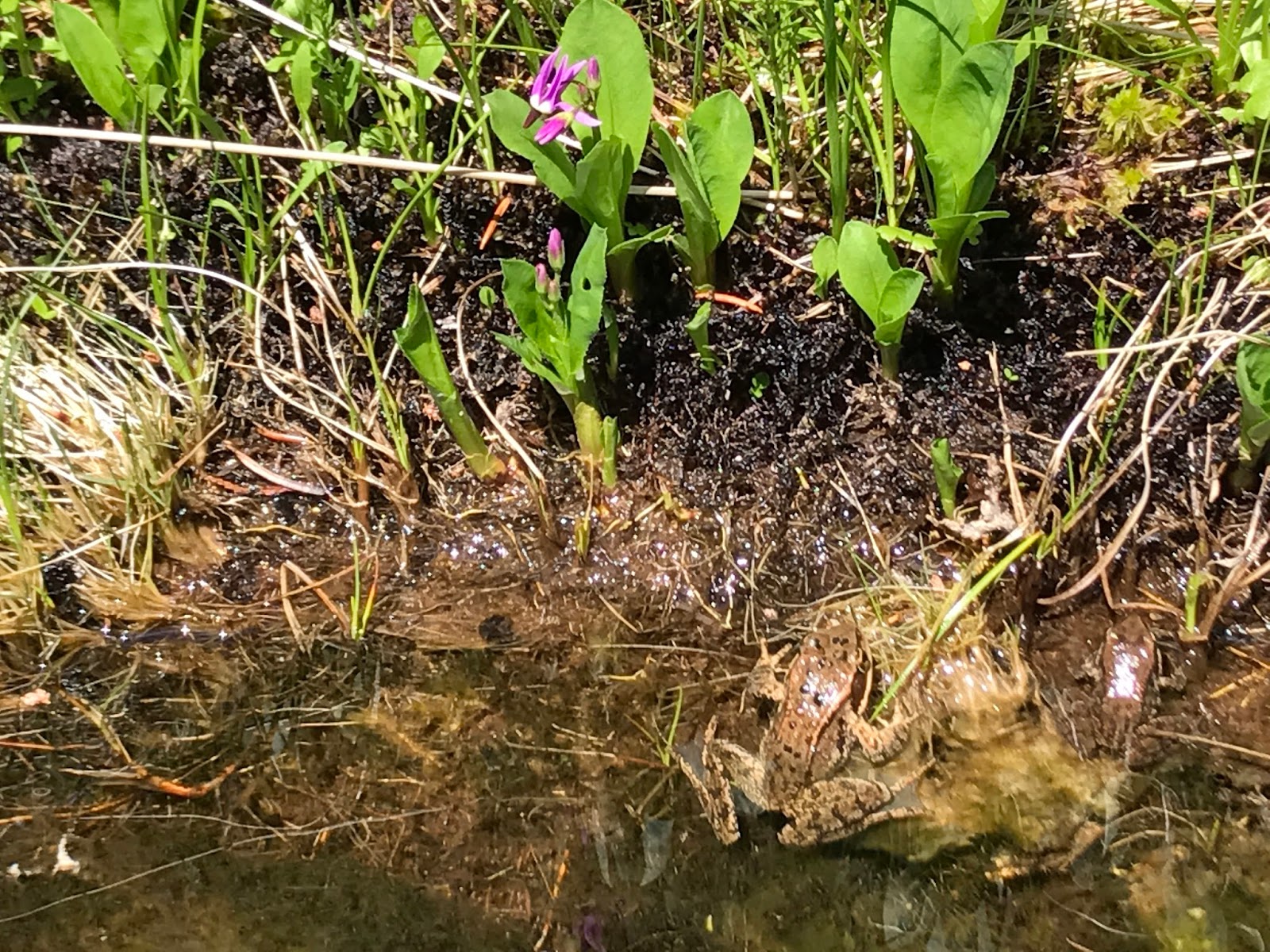
Cascade Frogs in one of the wetlands with Shooting Stars blooming.

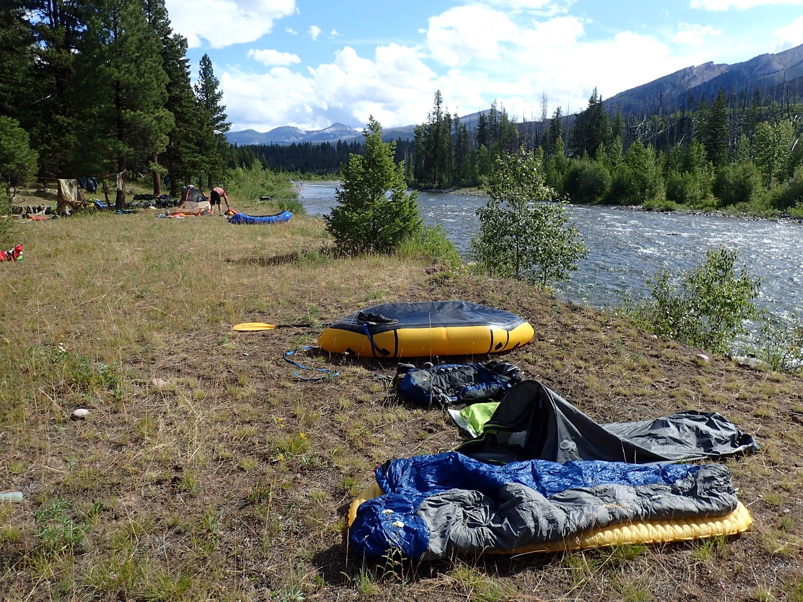
Monitoring our progress on the map and watching the sun get lower in the sky, I realized I wasn't going to actually make it to my original objective in one day. Just too far and the Slide Alder really slowed us down. The higher we got the quicker our progress was though, as the alder wasn't as thick, there were more snow patch clearings and the terrain wasn't quite as steep. Still, I identified on the map some flatter spots along the stream that looked like it might have some reasonable places for a tent. We reached a nice spot in time to set up a tent, take a dip in the stream, examine the ultralight wreckage on the bank, and make some dinner before dark.
We might need a bigger tent

Somewhere in the middle of the night, Tucker got cold and nose dived into my sleeping bag. We might need a bigger sleeping bag too.
The next morning, I first noticed that my camp spot was pretty darn scenic, then debated and ultimately decided to day hike to the lake as opposed to packing up everything. So we grabbed some lunch, water, and other essentials and again embraced the alders.


It actually didn't take too long before the alders let up and the bush whacking was much easier and enjoyable. The headwaters of the drainage was a branching network of streams, some on the map, others not. I only brought the map along on this trip so I made a guess on which ridge line to ascend and started climbing. I was aiming for treeline and a prominent col that appeared to support a lake, hopefully my lake.
Waterfall break before starting up the ridge.

The col I was aiming for


Once I reached the top I realized my mistake. Yes, there was a lake on the other side, only about 200 feet down a cliff below me, and not the lake I was shooting for. I quickly looked back and saw the ridge line and lake I should have navigated to.
The look you get when you climb 2,000 feet only to have ascended the wrong ridge line. You can see the lake in the distance.

So we stopped and ate some food before descending back to the basin. One obstacle we had to cross twice was a snowbridge crossing one of the head water creeks. By the fourth of July weekend it was plenty warm, and the snow was extremely soft. On the way up we gingerly and nervously made it across without incident. With the sun even higher now, I was wary to have to cross it again.
The braided stream and snowbridge crossing.

It was hard to tell other than by sound where the stream went under the snow and where a bridge might be weak. I pulled my ice axe out and probed as I went. I was starting to feel confident, when as I shifted my weight onto my front foot, I punched through. The snow bridge gave out and I was dangling my feet above about a 15 foot drop onto the rocks and meandering stream below. It wasn't a huge fall, but I definitely didn't want to fall through. Beyond being solo and having to deal with any twisted ankles etc, getting back through the snow would be extremely difficult. To add insult to injury, Tucker was still on the surface licking my face. I beached-whale crawled back onto the snow...trying to Tucker away in case he fell in too. Crisis averted I continued down then scrambled up a muddy slope to the proper lake and embraced my reward for the alder and beached-whale effort.


Kicking myself a little at the absolutely perfect campsite on a tiny peninsula pointing out into the perfect lake, I accepted the fact that I will just have to suffer my way back another time to camp there. I took a very cold dip (when in Rome) and then Tucker and I carefully worked our way down the muddy slope and back to camp. Not wanting to move camp for just one night, we packed up the next morning and retraced our steps back through the alder soup and the trail out. Once I find the fortitude to wade through the alders again, I'm sure we will make another attempt to camp along that high lake.